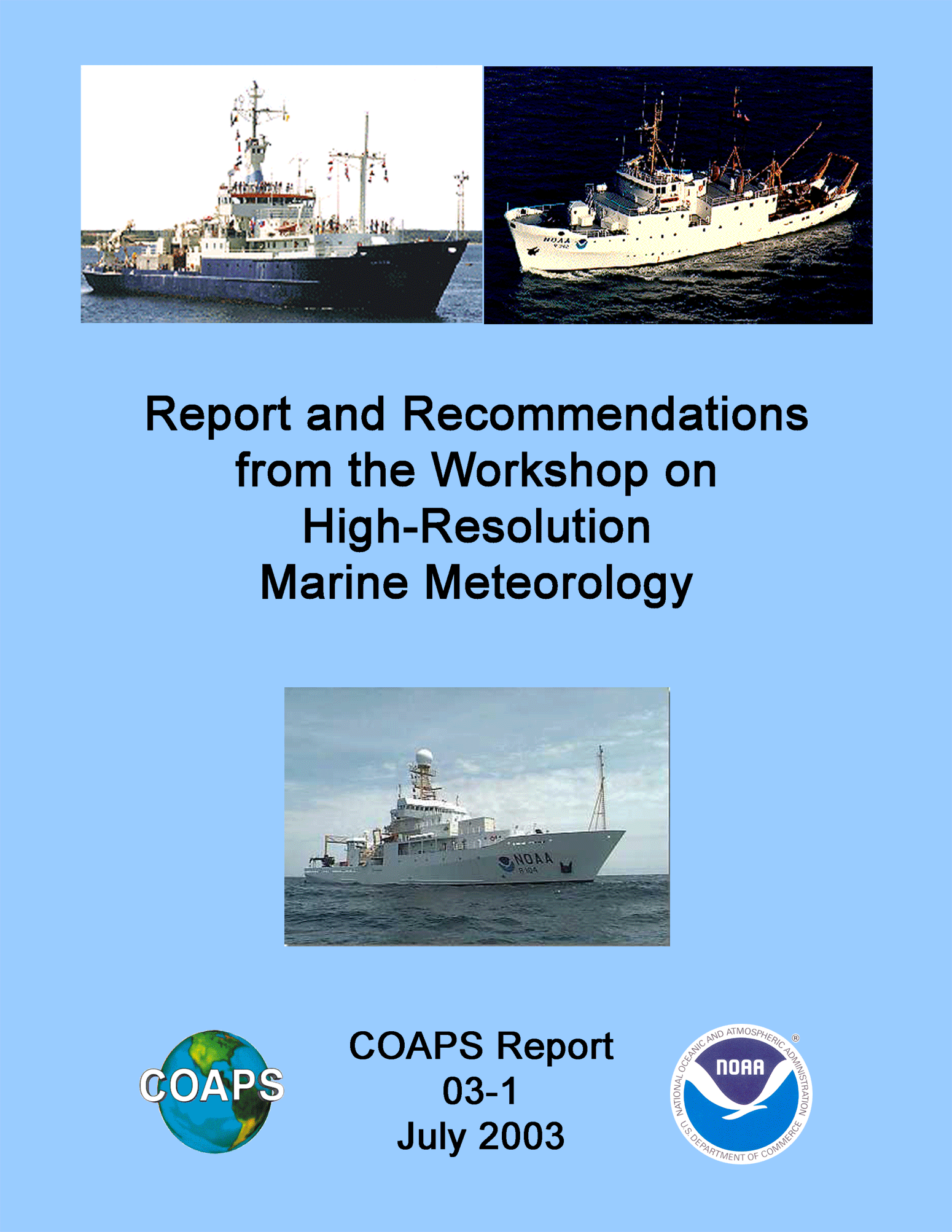
Report and
Recommendations
from the
Workshop on High-Resolution Marine
Meteorology
3-5 March 2003
Shawn R. Smith1 and R.
Michael Reynolds2
(co-chairs)
James J. O'Brien1
(host)
1Center for Ocean-Atmospheric
Prediction Studies
The Florida State University
Tallahassee, FL 32306-2840
USA
2Brookhaven National
Laboratory
Upton, NY 11973
Funded and sponsored by Michael
Johnson
NOAA Office of Global
Programs
COAPS Report 03-1
July 2003
The report presents a summary of the discussions and recommendations from the
"Workshop on High Resolution Marine Meteorology" held in Tallahassee,
Florida, USA from 3-5 March 2003. Workshop objective and format are described.
Abstracts for the invited talks are included along with a synopsis of the round
table discussions. The thirteen workshop recommendations are listed and a
discussion of each is included. The report concludes with action items and a
time table to begin implementation of the workshop
recommendations.
On 3-5 March 2003, the Center for
Ocean-Atmospheric Prediction Studies (COAPS), directed by Dr. James J. O'Brien,
hosted the "Workshop on High-resolution Marine Meteorology" in
Tallahassee, Florida. The workshop was sponsored by the NOAA Office of Global
Programs to identify scientific objectives that require high-resolution,
high-accuracy marine meteorological observations and to discuss a sustained
U.S. effort to obtain and disseminate these data in a manner consistent with
the identified scientific goals. The workshop focused on
in-situ marine meteorological observations from ships and
buoys. Central discussions included data accuracy, calibration and
inter-calibration, improved access to quality-assured, high-resolution
(sampling interval < 1 hr.) observations for the scientific community, and a
sustained observing system to meet short- and long-term science
objectives.
Co-chairs Dr. R. Michael Reynolds (Brookhaven National Laboratory) and Mr. Shawn R. Smith
(COAPS) organized a workshop panel with representatives from both the
scientific and operational marine observation communities. Participants
included personnel from four NOAA laboratories, the Naval Research Laboratory,
the U. S. Coast Guard, and the U. S. CLIVAR Office. The university community
was represented by the Woods Hole Oceanographic Institution, the Scripps
Institution of Oceanography, the University of Miami, Oregon State University,
and the Florida State University. International attendees included
representatives from CSIRO (Australia) and the Southampton Oceanography Centre
(United Kingdom).
The workshop was organized around four main topics: (1) science objectives; (2)
status of U.S. high-resolution observing programs; (3) accuracy, calibration,
and inter-calibration; and (4) a sustained data collection, distribution, and
archival system. Invited speakers began each session with talks to stimulate
topic-oriented discussions. Round-table discussions provided a free exchange of
ideas for improving both the quantity and quality of marine observations.
Several discussions focused on the need to improve instrument
calibration and to provide for routine inter-calibration between instrument systems and platforms
(e.g., ships versus buoys). Currently, only a select set of well maintained
ships and buoys are capable of determining air-sea interaction variables to a
sufficient degree of accuracy for climate studies (e.g., 10 Wm-2 net
heat flux uncertainty for monthly averages desired by CLIVAR). Participants
noted that while research vessels are able to provide the highest quality data,
often in under-sampled regions of the ocean, this resource is not being
effectively utilized and data essential to climate studies are being lost.
Discussions included the need to improve instrument siting on ships and to
standardize measurement of meteorological and ship motion parameters and
metadata formats. In addition, attendees addressed improving data quality and
access for the user community. The discussions resulted in thirteen
recommendations that the attendees agreed to disseminate widely through the
scientific and operational marine communities and at the program
level.
1. Develop a sustained system of calibrated, quality-assured marine meteorological observations built around the surface flux reference sites, drifting buoys, research vessels (R/Vs), and volunteer observing ships (VOS) to support science objectives of national and international climate programs.
2. Improve global data coverage, especially from important but data sparse regions (e.g., Southern Ocean), by working with and making use of national and international observing efforts, research programs, and infrastructure development initiatives.
3. Establish a data assembly center (DAC) for U.S. R/V (e.g., UNOLS, NOAA, Navy, Coast Guard) meteorological observations to unify data collection, quality assurance (QA), and distribution. The DAC will also provide for permanent data archiving and long-term availability of data at national archive centers.
4. Establish standards for sensor calibration and data collection on ships and moorings, including accuracy and resolution, sampling rates and averaging periods, data acquisition and display software, data transmission, recommended instrument siting, and provision of metadata.
5. Produce a reference manual of best procedures and practices for the observation and documentation of meteorological parameters, including radiative and turbulent fluxes, in the marine environment. The manual will be maintained online and will be a resource for marine weather system standards.
6. Develop a portable, state-of-the-art, standard instrument suite and implement on-board inter-comparison between the portable standard and shipboard instruments to improve R/V and VOS automated meteorological observations.
7. Endorse development of robust sensors for use in severe environments to improve data accuracy and allow accurate data to be collected from data sparse regions.
8. Implement a program in computational fluid dynamics (CFD) modeling of the wind flow regime over ships to determine optimal wind sensor siting, wind correction factors, and effective measurement heights.
9. Encourage (i.e. fund) R/Vs to schedule meteorological inter-comparisons with surface flux reference sites and, where appropriate, with one another.
10. Recommend that certain ship data not currently logged be made available to researchers (e.g., pitch/roll, heading, currents, speed of ship in water). These data should be routinely recorded to improve flux calculations and QA.
11. Encourage funding agencies to require that new shipboard meteorological instrumentation purchased within research grants be installed and operated, and the measurements distributed and archived according to the principles embodied in points 3-6 above.
12. Establish sources/contacts where expertise can be obtained by operators and made available for QA development.
13. Strongly encourage funding agencies to support human capital development through education and training.
A "Workshop on High-Resolution Marine Meteorology" was held at
the Center for Ocean-Atmospheric Prediction Studies (COAPS) from 3-5 March 2003.
The purpose of the workshop was to identify scientific objectives addressable
using high-resolution (sampling rates < 60 minutes), high-accuracy marine
meteorological observations and to discuss a sustained U. S. effort to obtain
these data in a manner consistent with the identified scientific goals. The
workshop was attended by members of the scientific and operational marine
observation communities, including representatives from government laboratories
and agencies, the university community, and two international oceanographic
institutions.
Workshop goals included: (1) identifying scientific objectives which can be
best achieved using high-resolution marine observations, (2) providing the community
with a current status of U. S. sponsored, high-temporal frequency, shipboard
meteorological data collection (including data distribution, availability to
meet science objectives, and current quality control practices), (3)
identifying technical and management issues related to instrument accuracy,
calibration, and inter-calibration that will benefit scientific application of
high frequency shipboard data, (4) developing a plan that insures routine
delivery (real-time and delayed) of calibrated, high quality surface
meteorological observations consistent with science objectives, (5) identifying
areas where a sustained high-resolution observing system can evolve to better
meet science objectives in the future, and (6) identifying areas where
collaboration and joint activities would increase both the quality and quantity
of data to better meet science objectives.
The workshop focused on in-situ marine meteorological measurements
collected at wide range of sampling rates on ships and moored buoys. Shipboard measurements
primarily include two groups of vessels: Volunteer Observing Ships (VOS) and
oceanographic research vessels (R/V). Until recently VOS weather observations
were collected by the ship's bridge officers at sampling intervals of one,
three, or six hours. These VOS reports were logged onboard the ship and
frequently were transmitted to shore via satellite or other communication
system. The advent of automated weather systems (AWS) for marine applications
has made it possible for VOS to continuously record meteorological
observations. This new class of VOS-AWS can provide data at multiple sampling
rates. Typically data are recorded onboard at one to ten minute intervals (some
may record even higher sampling rates); however, it is currently not cost
effective to transfer these high-resolution data to shore via satellite.
Instead, VOS-AWS often transmit hourly samples via INMARSAT or some other
transmission service. The high-resolution data are collected from the vessels
at regular intervals when the VOS-AWS reach a suitable port. R/Vs are
frequently outfitted with one or more suites of meteorological instrumentation
and are the test bed for new marine AWS systems. The R/Vs typically record
meteorological data continuously at sampling rates of one minute or less and
these data are logged through an onboard computer system. These high-resolution
R/V data are collected from the vessel's computer at the end of each cruise. It
is worth noting that these "scientific AWS" data are often logged
independently of the standard bridge observations collected by the crew of the
R/V. The scientific data are rarely sub-sampled and transmitted from the ship
in real-time.
The classes of shipboard platforms discussed at the workshop are listed in
Table 1. A number of shipboard data collection programs are listed for each data class
along with some typical applications for each type of data. VOS data and some
VOS-AWS data (e.g., SeaKeepers) are the primary real-time data to be
assimilated into models and used for numerical weather prediction forecasts.
The delayed-mode, higher sampling rate data from AWS are used for a wide range
of validation studies (e.g., model fields, satellite observations) and in the
case of R/V-AWS for regional process studies.
|
Table 1: Sampling
rates, representative programs/systems, and common uses of three classes of
marine meteorological observations from vessels. |
||||
|
Data Class |
Real-time sampling |
Delayed-mode sampling |
Data Programs or Sensor Systems |
Uses |
|
VOS |
1 to 6
hour |
N/A |
VOSClim |
Assimilation |
|
|
|
|
PMOs |
NWP
Forecasts |
|
|
|
|
GOOS |
|
|
VOS-AWS |
1
hour |
>10
min. |
ASIMET |
Assimilation |
|
|
|
|
AutoIMET |
Validation |
|
|
|
|
SEAS |
|
|
|
|
|
SeaKeepers |
|
|
R/V-AWS |
Rare |
1 min. or
less |
AutoFlux |
Independent
Validation |
|
|
|
|
ETL Flux
System |
Climate
products |
|
|
|
|
SCS
(NOAA/USCG) |
|
|
|
|
|
R/V specific
systems |
|
|
|
|
|
IMET |
|
Buoys can be separated into two large groups, moorings and drifters.
Moorings are nearly-stationary in space and provide a platform that can measure most
parameters observed on ships. Limitations to operating AWS on buoys include the
size of an instrument, instrument power requirements, and the ability of an
instrument to operate unattended for long periods of time. Moorings can further
be divided into research and operational categories. Operational moorings
(e.g., NBDC buoys, TAO/TRITON) typically record data onboard the buoy and
regularly transmit a subset of their data in real-time via satellite. Research
mooring collect data at high sampling rates (<10 min) and record these data
onboard until the buoy is retrieved. The research moorings may also transmit a
subset of data in real time, but these data are often withheld from NWP
products for validation purposes. Drifters provide a more limited suite of
meteorological observations (pressure, SST, and sometimes winds) that are
typically transmitted via satellite; however, drifters were not a primary focus
of the workshop.
AWS are deployed on ships and buoys to provide observations in support of
both operational and research science objectives. Although improvements are made
yearly, the spatial and temporal coverage by AWS is still limited in large
regions of the oceans (especially outside the tropics). Supporting current and
future science objectives for the operational and research communities requires
a commitment to improving both the quantity and quality of AWS observations in
the marine environment. For example, R/Vs are often equipped with AWS, but
access to these climate data are currently limited. Expanding access to R/V
data will provide researchers potentially valuable climate data far outside
normal VOS shipping lanes. Achieving the full potential of AWS on marine
platforms requires a sustained, end-to-end measurement system that includes
improved sensor calibration, platform inter-calibration, standardized data
collection, quality assurance, distribution, and archival. The requirements of
and recommendations for this system were the focus of discussions at the
"Workshop on High-Resolution Marine
Meteorology".
The meeting was formulated around four topic areas (1) science objectives,
(2) status of U. S. high-resolution data programs, (3) accuracy, calibration, and
inter-calibration, and (4) developing a sustained data collection and
distribution system. The meeting was opened with a welcome from the local host,
James J. O'Brien, and from the co-chairs, Shawn R. Smith and R. Michael
Reynolds. Michael Johnson, the workshop sponsor, followed with a brief
introduction of issues that NOAA wished to receive input from the workshop
participants. The four topic-oriented sessions followed these introductory
remarks, and each session began with talks by invited speakers. Abstracts for
each talk are included in the following section and portable document format
(PDF) files of the speakers talks are available online at
coaps.fsu.edu/RVSMDC/
marine_workshop/Workshop.html. At the end of each session, round table discussions provided for a free exchange
of ideas relevant to the four topic areas.
Several scientific objectives that require high-resolution, high-quality
marine meteorological data were discussed. One primary objective was
producing accurate estimates of the air-sea fluxes. All components of air-sea heat, momentum,
radiation, and carbon fluxes were discussed as important to achieving short and
long term science objectives. The need for both continuous direct flux
measurements and estimates using bulk algorithms was raised. High-quality
air-sea fluxes from vessels and buoys are essential to address problems of
validating new satellite sensors and providing uncertainty estimates for
operational and research flux fields (from GCMs or other data assimilation
methods). The goal of reducing uncertainties in flux fields is an essential
component of several international climate initiatives (e.g., CLIVAR, GODAE).
Participants discussed the need for more interaction and collaboration between
the in-situ marine data and modeling communities. Another scientific activity
addressable with high resolution marine data is the investigation of diurnal
cycles over the oceans.
A current status of their high-resolution meteorological measurements
programs was provided by NOAA/ETL, NOAA/AOML, NOAA/MAO, NOAA/PMEL, U.S. Coast Guard,
U.S. Navy, SIO, WHOI, UM/RSMAS, and OSU. The presentations revealed a diverse
level of both scientific and technical expertise that is devoted to collecting
marine meteorological measurements with a wide range of instrumentation
deployed on R/V, VOS, and buoys. In some cases, there was concern raised that
personnel collecting the data were lacking sufficient scientific and technical
input on critical elements including, but not limited to, sampling rate, data
accuracy, and instrument siting. Calibration practices and the level of data
quality control also varied widely between organizations. Some institutions
noted that data collection and QC have been explicitly separated in the funding
process, with QC falling on the shoulders of the chief scientist, not the data
collector. The presentations and subsequent discussions also showed that a
level of duplication in efforts to develop instrumentation, data logging and
display software, and other technology existed between the groups. Finally, a
large number of R/Vs (e.g., additional UNOLS vessels) and some mooring programs
(e.g., NDBC) were not represented at the workshop that clearly are a part of
the U. S. effort. Round table discussions made it clear that further work (see
action items) was needed to evaluate the current status of the U. S.
high-resolution observing program.
The technical discussion on accuracy, calibration, and inter-calibration of
high-resolution marine systems highlighted several areas where improvements and
new initiatives would lead to more, higher quality observations. Discussions
showed a clear need to improve lab calibration practices for marine AWS. Better
calibration will lead to improved accuracy of fluxes calculated from
high-resolution ship and buoy data. The need for uniform calibrations practices
across marine platforms and the need to better distribute information on these
practices was discussed. Platform to platform and instrument to instrument
inter-calibrations were both topics of many of the round table discussions.
Plans are moving forward to develop ocean flux reference sites and the workshop
participants agreed that inter-comparisons between these sites and nearby
vessels is essential. Further discussions centered around development of a
reference AWS to be used for onboard inter-comparison with different AWS
deployed on the U. S. R/V fleet.
Discussions related to data collection, quality assurance, distribution and
archival varied by data class. Much of the needs for VOS are being handled through long
established data pipelines. The VOSClim program is working to improve metadata
for the VOS fleet and has been working with a subset of the VOS fleet to
provide validation data for models. A wide range of QA practices exist for the
VOS-AWS programs. For example, SeaKeepers completes manual QA of data retrieved
for submission onto the GTS while VOS-IMET observations undergo post-cruise
evaluation at WHOI. Currently R/V data collection and distribution is handled
on a ship-by-ship, institute-by-institute basis, making high-quality R/V data
difficult to obtain and harder to use for operational and research purposes.
Data pathways, QA, distribution to users, and long term archival of both
real-time and delayed-mode VOS-AWS and R/V -AWS data are key issues that were
discussed as part of an overall management plan for U. S. sponsored
high-resolution marine meteorological data.
Climate Quality Buoy and Ship
Observations
Robert Weller, Dave Hosom, Frank Bahr,
Lisan Yu
Woods Hole Oceanographic
Institution
The state of the art of high resolution buoy and ship observations of marine
meteorology is briefly reviewed as are plans for the elements of the global
ocean observing system using these techniques. The motivations for collecting
these data and payoffs associated with using the data are summarized. Finally
the next steps associated with resolving present issues and continuing to make
progress are listed.
Surface moorings are now deployed for up to 1-year, instrumented to obtain the fluxes
of heat, moisture, and momentum by bulk formulae methods. Most locations in the
world's oceans are now accessible, but high current, high sea state, and
ice-covered regions are not. National and international planning has been done
to identify locations for a global array of time series stations, a subset of
which (known as Surface Flux Reference Sites) would have as one goal to collect
high quality, rapidly sampled (~1 minute) surface meteorological and air-sea
flux time series. High quality observations are also made on research vessels
and Volunteer Observing Ships (VOS), a subset of which are being equipped with
IMET systems. The intent is to eventually upgrade the surface
meteorological/air-sea flux capability of the ships that carry out the
high-resolution XBT lines in each basin. Well-equipped research vessels
complement these data by going to sparsely sampled regions and be being able to
carry out more sophisticated observations, such as turbulent
fluxes.
Accuracy that can be achieved in air-sea fluxes using mean meteorological sensors and
bulk formulae has greatly improved over the last 20 years. The accuracy of
weekly averages of the net heat flux now approaches 10 Wm-2. With
that accuracy buoy observations have proven to be very valuable in identifying
biases and errors in numerical weather prediction and climatological fluxes,
pointing to the monthly averages of net heat flux from these sources as
sometimes having the wrong sign and being in error by up to 100
Wm-2.
This capability has led to the development of a strategy to improve basin scale
air-sea flux fields in which high quality time series stations are used as
anchor points to identify problems with gridded fields from models and remote
sensing and where high quality ship observations are used to quantify the
spatial structure of those errors. The goal is to produce daily, 1°x1° gridded
fields of improved fluxes. This is being done in a pilot project in the
Atlantic and has been done as a trial example in the Indian Ocean for
1988-1994.
At
this point there is the need to work on sensor improvements (particularly
incoming longwave radiation and gimbaling/correction of incoming shortwave for
motion an/or tilt), for implementing a sonic anemometer as a more robust sensor
for mean winds, and for measuring platform tilts (mean and instantaneous) to
allow correction of errors associated with tilt and to develop the capability
to measure surface waves. We should also work to implement the capability to
measure turbulent fluxes on buoys to continue to address the uncertainties in
the bulk formulae and to continue to evaluate, test, and perfect the
calibration of all sensors. Communication bandwidth from buoys should be
improved as should on board power generation capability. Buoys are being
developed under the NSF Ocean Observatories Initiative (OOI) that should
address some of these issues and also provide improved access to
severe environments.
The observing programs need to engage the following communities in the effort
to develop basin scale fluxes:
remote sensing, numerical weather prediction and more generally the
atmospheric modelers, climate modelers and investigators, and those using
surface meteorological and air-sea flux fields to force ocean models and
quantify air-sea coupling.
Actions items are thus: work on sensors,
work on calibration and inter-calibration across the observing elements, work
of performance characteristics of the platforms (flow disturbance, heat island
effects, RF radiation issues, motion effects), work on turbulent observing
capability and flux algorithms, and attention to working with users including
developing data archiving and quality control.
Uses of high quality meteorological
observations in climate studies
Elizabeth Kent, Peter Taylor, Margaret Yelland,
and David Berry
Southampton Oceanography
Centre
This abstract describes some of the research projects at the Southampton
Oceanography Centre which use surface meteorological data in climate-related
studies.
AutoFlux is an autonomous atmospheric measuring system developed by a group
of partners under the MAST-3 programme of the European Union. AutoFlux measures surface stress, sensible and latent heat
flux and also carbon dioxide flux along with mean surface meteorological
parameters. The system is aimed
primarily towards unattended use on Voluntary Observation Ship (VOS) and buoys
and has been successfully deployed unattended on research ships. The fluxes are derived from the
turbulence spectra using the "inertial dissipation" method. Hourly summaries of flux and
meteorological information are transmitted by satellite and received
by email to allow remote routine monitoring and maintenance planning. The system is modular and so will take
advantage of improved flux instruments as they are
developed.
VOSClim is the World Meteorological Organization VOS Climate Project. The aim is to provide a high-quality
set of marine meteorological observations from VOS with detailed information on
how the data were obtained. The
VOSClim data will be used for operational marine forecasting and provide
high-quality data for model validation and ground truth for the calibration of
satellite observations. A further
use for the data will be the characterization of meteorological data from VOS
necessary for climate studies.
Currently more than 70 ships are providing 6-hourly meteorological
reports which are collected in real time by the UK Met Office and merged with
the output of their numerical weather prediction model. The merged data are then sent to NCDC
(the US National Climatic Data Centers) along with delayed mode data containing
extra parameters which the ships have agreed to report. Port Meteorological Officers are
collecting extensive metadata which will allow us to understand the factors
that affect the quality of marine meteorological observations from this subset
of VOS. It is expected that the
VOSClim dataset will be available in the spring of 2003 with regular updates as
the project continues.
Marine meteorological data with high time resolution are particularly important for studies where the diurnal cycle is important. An example is an attempt to remove the effects of radiative heating from ships measurements of air temperature. The aim of this research is to model the effects of solar radiation on the air temperature using an analytical model with empirically fitted coefficients. The model will be used to correct VOS air temperatures which are reported every 6-hours but testing of the model has started with higher resolution data to ensure the diurnal cycle is adequately modeled.
Near-real-time wind and surface pressure from
SeaWinds
James J. O'Brien
COAPS, The Florida State
University
Abstract not available.
Partial pressure of CO2 measurements
from VOS:
Why do we need high-resolution
observations?
Rik Wanninkhof
NOAA/AOML
The overall objective of the interagency US Carbon Cycle Science Program is
to reduce uncertainties in fluxes between the major labile carbon reservoirs. The
ocean is the largest of the three reservoirs containing approximately fifty
times more carbon than either the atmosphere or the terrestrial biosphere. A
focus of the ocean work is quantification of exchange of CO2 between
the ocean and atmosphere on regional and seasonal basis to 0.2 Pg C
yr-1 (1 Pg = 1015 gr). To determine this exchange on seasonal time
scales, the surface water gaseous partial pressure of CO2
(pCO2)
must be determined along with the gas transfer velocity, which is the kinetic
driving force of gas fluxes. The latter is often parameterized with
wind.
To increase the number of pCO2 samples and create regional pCO2 maps, autonomous measurements are being started on research ships and volunteer observing ships (VOS). The calculation of the pCO2 from the instrument readings on the ships requires accurate co-located temperature and salinity information. Quality controlled temperature and salinity has often been the Achilles heel for the overall accuracy of the pCO2 measurements. Translating the pCO2 to an air-sea flux requires high-resolution winds on time scales of hours. Interpolation over larger space and time domains can be done with regional temperature, salinity and wind products. Therefore, measurements of surface physical parameters and marine meteorology both in-situ and remotely is a high priority for ocean carbon research.
Role of high-resolution marine meteorological
observations
in global climate
research
David M. Legler
U.S. CLIVAR Office
The Climate Variability and Predictability program (CLIVAR) focuses on the
physical aspects of the coupled climate system, and addresses the question: What causes the changes of the earth's
climate on time scales from seasons to centuries and can we predict it?
Examples of changes (or variability) can be found in the worlds ocean basins.
Mechanisms that govern and generate modes of variability such as El
Niño-Southern Oscillation (ENSO), Pacific Decadal Oscillation, Northern Annular
Mode (i.e. NAO), and the Tropical Atlantic Variability (TAV) are not well
known, but the ocean plays a critical role, and the coupling between the ocean
and atmosphere in particular must be better quantified, described, and
monitored in order to accurately model the coupled system
(particularly the ocean) and indicate any change. Air-sea fluxes of heat, momentum, and fresh water are
the measures of this coupling, but global fields of these variables are
difficult to obtain and the uncertainties of many currently available fields are unacceptably
large. The prospect of a network of high-resolution, high-quality surface
marine meteorology observations that will anchor flux fields at select
locations and also provide characteristics of these fields in the spatial
domain is especially welcomed by CLIVAR. Such an observation network could be
used to validate any number of flux fields (satellite, NWP) and products, on a
wide variety of time and space scales. A plan to develop this network address
these needs of the climate research community:
Consistent data and metadata
Data quality attributes and better inter-calibration within
the network
Delivery of data as much as possible in real-time
Value-added products helpful to users, and
Assessment of these observations in context of other observing systems
and products (routine VOS, satellite, other products)
An example of the use of
high-resolution research vessel data was the recent comparison of a large
collection of this data to the NCEP reanalysis surface meteorology and air-sea
flux fields. The study highlighted numerous deficiencies in the NCEP fields and
the NCEP flux algorithms.
Shipboard monitoring of
stratocumulus cloud properties in the PACS region
Chris W. Fairall
NOAA Environmental Technology
Laboratory
In this project we implemented a modest ship-based cloud and flux measurement
program to obtain statistics on key surface, mean boundary layer (MBL), and
low-cloud macrophysical, microphysical, and radiative properties. The
measurements were made as part of the PACS/EPIC monitoring program for the 95°W
and 110°W TAO buoy lines in the tropical eastern Pacific (Cronin et al. 2002).
Our goal was to acquire a good sample of most of the relevant bulk variables
that are commonly used in GCM parameterizations of these processes. These data
are being compared to known relationships in other well-studied regimes. While
not comprehensive, these data are useful for MBL/cloud modelers (both
statistically and for specific simulations) and to improve satellite retrieval
methods for deducing MBL and cloud properties on larger spatial and temporal
scales.
The
primary objectives are to
1.
Obtain
new measurements of near-surface, cloud, and MBL statistics for comparison to
existing data on northern hemisphere stratocumulus
systems.
2.
Obtain
quantitative information on cloud droplet and drizzle properties and
probability of occurrence of drizzle and possible links to deviations from
adiabatic values for integrated cloud liquid water
content.
3.
Examine
applicability of existing bulk parameterizations of stratocumulus radiative
properties for the Peruvian/Equatorial regime.
4.
Characterize
surface cloud forcing and possible ocean-atmosphere coupling through
stratocumulus SST interactions.
5.
Provide
periodic high quality near-surface data for inter-comparison with ship-based
IMET and buoy-based meteorological measurements.
6.
Provide
high quality measurements of basic surface, MBL and cloud parameters for
'calibration' of satellite retrieval techniques.
Status of the SEAS
program
Steve Cook
NOAA/AOML
NOAA's Global Ocean Observing Systems (GOOS) Center has developed
the SEAS 2000 software package which will support the automated real-time
transmission of high resolution meteorological data from those selected vessels
(both research and Voluntary Observing Ships) outfitted with climate quality
sensor packages. Plans are to have three Voluntary Observing Ships on line by
the end of 2003. Additionally, plans are evolving to integrate the NOAA
research fleet as high resolution reporters. The GOOS Center will continue to
integrate sampling systems into SEAS 2000, assist in the data QC, management
and coordination of those systems as well as continue to act a focal point to
the Voluntary Observing Ship network.
Underway systems on SIO
vessels
Woody Sutherland and Carl
Mattson
Scripps Institution of
Oceanography
Abstract not available.
Overview of the R/V
Wecoma DAS
system
Linda Fayler
Oregon State
University/COAS
The manner in which the meteorological and flow-through systems
are implemented on the UNOLS
intermediate class research vessel Wecoma is detailed. A quick overview of the
various types of equipment used and their placement on the ship is included. The manner in which the data are collected, including the
sampling rates, periods over which data is averaged, and the program language
is described. Data record structure is presented along with the other types of
documentation files, which are included with the data CD created for each
science cruise. Why this system is not a high-resolution system is then
discussed. In summary, ways in which the system on Wecoma might be improved are
outlined.
Status of vessels operating with
SCS
Dennis Shields (presented by M.
Reynolds)
NOAA/MAO
Abstract not available.
Marine Meteorological Measurements
from the USCG Polar Class Icebreakers.
Phil McGillivary
US Coast Guard Icebreaker Science
Liaison
The USCG operates three icebreakers for high latitude logistics
and research for the U. S. government and all federal agencies, with the ships
based out of Seattle, Washington. These vessels include two 399 ft. Polar class
icebreakers, Polar Star (NBTM) and Polar Sea (NRUO), which are the principal ships tasked with the annual
mission to break an ice channel in to McMurdo Station in the Ross Sea,
Antarctica, to permit re-supply of the base during the austral summer (northern
winter). Typically this mission is carried out by one of the Polar icebreakers,
with the second vessel held in reserve. However in the past two years, heavy
ice conditions have required the use of two icebreakers, a condition
anticipated to persist for the foreseeable future. Normally, one or both of the
Polar Class icebreakers also conducts research in the arctic during the
northern summer, typically calling at Barrow, Alaska, during their summer
missions. A new icebreaker, the 420 ft. Healy (5LZE), began its' mission as an
arctic research vessel in 2001. In transiting from the eastern to the western
arctic, the Healy
has gone through the Canadian Northwest Passage once, and once transited
through the Panama Canal. Future transits of the arctic will likely involve
these routes again, as well as periodic transits across the North
Pole.
The annual cruise track of the Polar class icebreakers from
Seattle to
Antarctica to
Seattle to Barrow, Alaska, provides them an annual latitudinal range of
standard operations greater than any other U. S. research vessel. This great
latitudinal range drives many of the research objectives of meteorological
measurements from these ships. Principal research objectives for which marine
meteorological measurements from the icebreakers have been or can be used
include: (1) high latitude inputs to weather/climate models; (2) satellite
calibration/validation of existing and newly launched environmental observing
satellites (including taking identical satellite sensor systems aboard the
ship); (3) air-sea flux measurements involving elemental budgets, including
hydrogen, carbon (as CO2), sulfur, and halogens; (4) correlation of ship
sensors with those from radiosondes, Global Ocean Observing System (GOOS)
floats, ARGO floats, SOLO floats, ice buoys, and autonomous underwater vehicles
(AUVs) deployed during icebreaker missions; (5) comparison with data from high
latitude underwater observatories now existing (e.g., on Little Diomede Island)
and planned (the PRIMO observatory in McMurdo Sound, Ross Sea, Antarctica);
and, finally, (6) studies of physical and chemical fluxes relating to "ice
breeze" phenomena at the edge of pack ice, as well as similar flux studies
at leads and polyn'yas in the ice. In the future, high latitude ship-collected
marine meteorological data can be useful for several studies proposed to focus
on the relation of solar/sunspot maxima to Earth's meteorological fields as
well as "space weather" (c.f. CAWES, the 2003-2007 program on Climate
And Weather in the Sun-Earth System).
A wide range of issues are presented related to sensor calibration, data
management, and the complications of placing additional sensors on the
icebreakers. Sensor calibration is typically done before and after each
scientific cruise. The annual track of the ship to Barrow, Alaska combined with
the fact that the ship instrumentation are identical to those installed at the
Barrow ARM site allows for regular sea-truth and instrument inter-calibration
with the Barrow ARM instruments. Onboard data management is handled by the NOAA
SEAS-V software. Standard data are transmitted via INMARSAT at four hour
intervals to NODC. At the end of each mission, a CDROM of all data collected
are provided to scientists involved. Requests to improve or add sensors to the
icebreakers have been increasing; however, maintaining additional sensors
properly is beyond the ship's current force capabilities. Deployment and use of
new sensors can be accommodated when personnel serving as instrument minders
are provided through separate funding (e.g., university or government
agencies).
An important value of marine meteorological sensors on the Polar
Class icebreakers is to provide data for satellite calibration and validation
over the great latitudinal range they cover during their annual transits. Ship
wind sensor data can be used for validation of winds obtained from the
currently operational QuikScat satellite. Calibration/validation of these winds
over the sea will soon be of increasing importance as QuikScat winds are about
to be incorporated into Navy global operational wind and weather models. In the
near future shipboard wind data may be used to calibrate/validate wind data
obtained from the NASA SeaWinds sensor on the Japanese ADEOS-II satellite.
Currently all three USCG icebreakers have been active in providing sea truth
data for ENVISAT, the first satellite to be able to distinguish snow depth as
separate from sea ice thickness when sea ice is snow-covered. A radar system
similar to that on ENVISAT was mounted on the Healy in summer of 2001 in the eastern
arctic by ENVISAT PI Son Nghiem (NASA JPL). Similarly the icebreakers will be
used during the 2003 and subsequent seasons to measure sea ice thickness for
calibration/validation of ICESat, launched by NASA in March 2003, and can
provide similar data for ice thickness estimates from the MODIS sensors on
NASA's AQUA satellite. Atmospheric moisture and aerosols are particularly
important aliasing components of satellite remote sensing data, and additional
sensor information on these parameters can further broaden the range of
satellite calibration and validation information for the new suite of
NASA-launched earth-observing satellites.
In summary, the annual cruise tracks of the Polar Class
icebreakers, Polar Sea and Polar Star, from 70°North to 70°South latitudes permit collection of high
resolution marine meteorology data that can make a significant contribution to
a wide range of scientific community interests, as well as global weather and
environmental models.
Aerosol Observations and Modeling
Briefing: T-AGS 60 Class Ship Battle-space
Characterization
Jeff S. Reid
Aerosol and Radiation Modeling
Section, NRL Monterey CA
The Marine Meteorology Division of the Naval Research Laboratory
in Monterey, CA has an ongoing program to model and monitor significant aerosol
events globally. The Navy Aerosol Analysis and Prediction System (NAAPS) is a
global 1x1 degree prognostic aerosol model that runs out to 120 hours. Current
aerosol species modeled include dust, smoke and urban pollution. While NAAPS
captures large visibility reducing events well, there is an ever-increasing
need to predict visibility to finer and finer resolution. Hence, a development
program has begun using 9 km mesoscale models. As aerosol forecasts move to
high resolution, validation methods must follow similarly. Our section intends
to develop a mobile package capable of deployment on the Naval Oceanographic
Office (NAVOCEANO) T-AGS 60 survey vessels. In this talk, we describe our
package for measuring visibility, aerosol particle size and chemistry,
micro-pulse lidar, and high resolution meteorology.
IMET (Improved METeorology) Status for Buoys,
Research Vessels, and Voluntary Observing Ships
David Hosom
Woods Hole Oceanographic
Institution
IMET was designed starting in 1988 to meet the WOCE standards for measuring heat
flux to 10 Wm-2. The sensors were tested to meet these standards and
consist of: wind speed and
direction, barometric pressure, relative humidity and air temperature,
precipitation, sea surface temperature, shortwave radiation, and longwave
radiation. The system architecture consists of individual modules that can be
polled using a modified SAIL protocol, using a central data logger via RS485 or
RS232. Calibration constants are internal to the module for ease of replacement
in the field.
There are three versions of IMET. (1) The original "Old IMET" consisting of the
selected sensors and a set of PC boards for analog interface, A/D conversion,
and communications. (2) ASIMET
uses the same sensors with lower power improved electronics and more rugged
titanium housings. These modules can be polled by an external computer as well
as operating stand-alone using internal batteries and a data logger. (3)
AutoIMET (for VOS) uses the same sensors and electronics as ASIMET in a lower
power integrated package that operates from batteries and has wireless
communications to the ship bridge and to the sea surface temperature located
inside the hull at the waterline. Of special interest is the HullCom acoustic
modem that uses the ship hull as a data path for SST. A 99% data return has
been achieved on ocean cruises from this device.
A
list of operational IMET systems includes 7 R/V's, 45 buoys, and 2 VOS (with 2
more VOS planned). Buoy options at WHOI include 3-meter discus buoys with two
complete systems and coastal buoys with single simplified modules and data
logger.
The IMET data accuracy and precision was specified to meet the WOCE requirement of
10 Wm-2 and has demonstrated this in the field. A critical part of
the accuracy is a six month (one year on ocean buoys) calibration cycle that is
performed at WHOI.
Shipboard Radiometric Measurements of Some
Surface Meteorological Parameters
Peter J. Minnett
University of Miami/RSMAS
Some of the variables required for high resolution ship-board data sets can
be measured using well-calibrated radiometers. These variables include skin
sea-surface temperature and air temperature. If measurements of the atmospheric
emission in the infrared are taken with sufficient spectral sampling, then
atmospheric profiles of temperature and humidity can also be obtained. One
instrument capable of providing such measurements is the Marine-Atmospheric
Emitted Radiance Interferometer (M-AERI), a Fourier-Transform Infrared
Spectroradiometer that has been used on many ships over several years. One such
deployment is on the Royal Caribbean Cruise Lines ship "The Explorer of the
Seas" which undertakes a weekly cruise round the Caribbean region from the Port
of Miami. A M-AERI has been installed on this cruise ship for over two years
and has provided a valuable data set which has been used in the validation of
SST measurements from satellites. Other instruments, lacking the spectral
coverage and resolution of the M-AERI, are also providing skin SST measurements
for satellite validation, and many of these were brought recently to the
University of Miami for cross-calibration against NIST reference standards, and
for a short cruise. The results of these exercises show that these radiometers
are sufficiently well calibrated and stable that they can be deployed
independently yet have their measurements combined to supply merged data sets
for satellite validation. With funding from NOPP, a new project is getting
underway to develop and demonstrate an autonomous, self-calibrating,
automatically-reporting radiometer suitable for deployment on the VOS fleet,
primarily for satellite skin SST validation.
An important contribution of the M-AERI to marine meteorological
measurements is the measurement of near-surface air temperature. This measurement is largely
independent of heat-island effects of the ship and direct solar
heating of a thermometer. Also air-sea temperature differences can be measured with a single
well-calibrated sensor. Comparisons of radiometrically and conventionally
measured air temperatures show marked differences, especially in the tropics,
where the radiometric measurements show very much reduced diurnal
signals
On radiation measurements
at sea
R. Michael
Reynolds
Brookhaven National
Laboratory
Abstract not available.
Inter-comparison of WHOI, PMEL, JAMSTEC, and
BNL
meteorological
observations
Paul Freitag
NOAA/PMEL
During May and June 2000, an inter-comparison was
made of buoy meteorological systems from the Woods Hole Oceanographic
Institution (WHOI), the National Oceanographic and Atmospheric Administration
(NOAA), Pacific Marine Environmental Laboratory (PMEL), and the Japanese Marine
Science and Technology Center (JAMSTEC). The results of this inter-comparison
have been published as a WHOI report (WHOI-2002-10) by R. Payne et al. (2002).
Two WHOI systems mounted on a 3 m discus buoy, two PMEL systems mounted on
separate buoy tower tops and one JAMSTEC system mounted on a wooden platform
were lined parallel to, and 25 m from, Nantucket Sound in Massachusetts. All
systems used R. M. Young propeller anemometers, Rotronic relative humidity and
air temperature sensors, and Eppley short-wave radiation sensors. The PMEL and
WHOI systems used R. M. Young self-siphoning rain gauges, while the JAMSTEC
system used a Scientific Technology ORG-115 optical rain gauge. The PMEL and
WHOI systems included an Eppley PIR long-wave sensor, while the JAMSTEC had no
longwave sensor. The WHOI system used an AIR DB-1A barometric pressure sensor.
PMEL and JAMSTEC systems used Paroscientific Digiquartz sensors. The
Geophysical Instruments and Measurements Group (GIM) from Brookhaven National
Laboratory (BNL) installed two Portable Radiation Package (PRP) systems that
include Eppley short-wave and long-wave sensors on a platform near
the site.
It was apparent from the data that for most of the
sensors, the correlation between data sets was better than the absolute
agreement between them. The conclusions made were that the sensors and
associated electronics from the three different laboratories performed
comparably.
Improving Flux Measurement Accuracy:
Experiences of the TOGA-COARE Air-Sea Interaction (Flux)
Group
Frank Bradley
CSIRO Land and Water,
Canberra
The TOGA Coupled Ocean-Atmosphere Response Experiment (COARE) "Flux Group"
was formed to coordinate analysis of the surface meteorological and ocean data-sets
obtained on the 10 ships and the central IMET mooring. COARE planners had set a
goal of 10 Wm-2 for the accuracy of net heat exchange which, in the
context of bulk fluxes, implied that sea and air temperatures, humidity, and
wind speed must be measured to within 0.2 K, 0.2 gkg-1,
and 0.2 ms-1 respectively. However, initial analysis of two days of underway
inter-comparisons between the platforms revealed discrepancies in these
variables and also the radiative flux components which exceeded these targets.
Examples are given of such errors and the correction procedures for some of the
more critical variables for flux calculation. The legacy of this experience of
improving measurement accuracy in COARE is illustrated for subsequent air-sea
measurement programs in the Indian (JASMINE 1999) and eastern Pacific (EPIC
2001) oceans. Calculations of sea skin temperature using the cool skin and
diurnal warm layer models in the COARE 3.0 bulk algorithm are compared with
direct measurements by an IR radiometer. Results of rainfall measurement by
various in-situ sensors aboard
ship are also given. Many of the sensor types used in COARE remain in
widespread use today, but better accuracy can be obtained by improved practice; frequent calibration and
maintenance (particularly for radiation sensors), on-line monitoring
of signals, replication and attention to location of instruments, and inter-comparison with
other platforms on site.
Application of R/V Data to Satellite
Calibration/Validation
Mark A. Bourassa
COAPS, The Florida State
University,
The accuracy of vector winds from the SeaWinds scatterometer on the
QuikSCAT satellite is assessed through comparison with observations from research
vessels. Several factors that contribute to uncertainty in scatterometer winds
are isolated and examined as functions of wind speed. The independent sources
of uncertainty considered herein are ambiguity selection, wind speed, wind
direction (for correctly selected ambiguities), variability associated with
spatial separation between scatterometer and ship observations, and
random errors in the ship observations. Ambiguity selection refers to the selection of a
unique scatterometer wind direction from multiple likely solutions. For
SeaWinds on QuikSCAT, ambiguity selection is found to be near perfect for
surface wind speed (w) >8
ms-1; however, ambiguity selection errors cause the directional
uncertainty to exceed 20°
for w < ~5 ms-1.
Improved statistical methods that account for the spatial variability in the
winds and uncertainty in the ship data are applied to determine
uncertainties in speed and direction separately for correctly selected ambiguities. These
uncertainties (averaged over the full comparison set) are found to be
0.45 ms-1
and 5° for the QSCAT-1 model function and 0.3
ms-1
and 3° for the Ku-2000 model
function.
Fine temporal resolution observations are needed to apply effective
automated quality assurance (QA) to the observations. A QA technique is developed to flag
suspect data. Problems we have identified are often associated with changes in
the ship motion and with flow distortion. The differences in comparisons of
satellite and in situ observations, with and without flagged data, are
statistical significant. Flagged data is not used in the final
comparison.
A wind speed dependent model for the uncertainty in the magnitude of vector errors is developed. For the QSCAT-1 (Ku-2000) model function, this approach shows ambiguity selection dominates uncertainty for 2.5 < w < 5.5 ms-1 (0.6 < w < 5.5 ms-1), uncertainty in wind speed dominates for w < 2.5 ms-1 and 5.5 < w < 7.5 ms-1 (w < 0.6 ms-1 and 5.5 < w < 18 ms-1), and uncertainty in wind direction (for correctly selected ambiguities) dominates for w > 7.5 ms-1 (w > 18 ms-1). This approach also shows that spatial variability in the wind direction, related to inexact spatial co-location, is likely to dominate rms differences between scatterometer wind vectors and in-situ comparison measurements for w > 4.5 ms-1. Application of these techniques leads to more accurate estimates of observational uncertainty.
VOS IMET data retrieval, processing, and
distribution
Frank Bahr, David Hosom, and Robert
Weller
Woods Hole Oceanographic
Institute
We describe the current data retrieval, processing, and distribution steps
for data sets from VOS ships equipped with WHOI IMET systems. We introduce our web
site, which provides general information on these ships as well as specific
information on individual deployments, including plots of raw data and example
data products. Obtaining a complete GPS record has been difficult until now,
but we list several possible solutions that will address this problem in the
near future.
The current data retrieval and processing steps for data sets from VOS
ships equipped with WHOI IMET systems are described. A web site is introduced that
provides information on these ships and on the data processing, and includes
plots of the raw data and of example products. A remaining problem of obtaining
GPS time series reliably is addressed. We identify several possible solutions
that should alleviate this problem in the future.
International SeaKeepers Society
high-resolution VOS data system
Edward Kearns
RSMAS, University of Miami
The
International SeaKeepers Society (http://www.seakeepers.org) is a privately
funded, non-profit organization which has developed and deployed an inexpensive
($50k), autonomous meteorological and oceanographic sensor and data
transmission package on dozens of ships. The SeaKeepers
meteorological data have been provided as a component of the VOS (Volunteer Observing Ship) program
since June of 2001 through routine delivery of WMO FM-13 and FM-62 formats to
the National Weather Service. NOAA's National Center for Environmental
Prediction (NCEP) routinely tracks the quality and quantity of data from the
global VOS program, and they agreed to help the International SeaKeepers
Society assess their new system by tracking their new observations
independently as well. How have the SeaKeepers meteorological systems
performed? During the 18-month period from June 2001 until the end of 2002, 16
different SeaKeepers systems reported 13,803 observations from locations around
the world's oceans under the SeaKeepers anonymous call sign KSnnn (where nnn is
a 3 digit number). While these limited observations were not as geographically
widespread as the 142,190 observations from the rest of the global VOS fleet --
comprised of 1,715 ships -- during the same time period, they are far more
efficient and demonstrably more accurate due to the automated data collection
and the high quality of the instrumentation installed. By NCEP's measure, the
SeaKeepers vessels' data quality ranged from about the same (barometric
pressure) to significantly better (wind speed, air temperature, and sea surface
temperature) with regards to bias and scatter than the rest of the VOS fleet.
While the measurement systems have already proven to be more accurate and
prolific than that of the typical VOS, SeaKeepers and its science advisors are
pushing ahead with new data quality controls and data management systems that
will raise the quality of the measurements to an even higher level. The
SeaKeepers program is currently expanding beyond super-yachts and cruise ships,
and new systems are currently installed on a variety of ferries, piers, buoys,
lighthouses, and merchant vessels. The SeaKeepers network will be in a position
to make an even more substantial contribution to the daily monitoring of the
ocean's weather and climate during the upcoming years. In particular,
SeaKeepers would like to target the data-limited areas of the Indian and South
Pacific oceans for expansion, as well as the coastal areas of many developing
nations in the Caribbean, South American, and African regions.
Vision for a delayed-mode high-resolution
marine meteorology data center
Shawn R. Smith
COAPS, The Florida State
University
A
vision for establishing a delayed-mode data assembly center (DAC) for automated
weather system (AWS) observations from research vessel (R/V) and select
volunteer observing ships (VOS) is outlined. The vision is based on COAPS'
eight years of experience as a data center that collects, quality controls
(QC), and distributes surface meteorological data collected by R/Vs. Past
experience with the World Ocean Circulation Experiment and TOGA/COARE allowed
COAPS to develop the contacts, tools, and expertise to quality process and
distribute delayed-mode AWS data. These data typically include full resolution
(1 minute or less sampling rates) navigation, meteorology (wind, temperature,
pressure, moisture, rain, radiation), and some ocean (SST, salinity,
conductivity) parameters. Currently, these data are managed on a ship-to-ship
basis, with data being provided primarily to scientist from each cruise and
sometime being placed in a data library at the vessels home institution. For
researchers, these data are difficult to obtain, especially when a large number
of cruises are desired.
The vision promoted would establish a single central DAC who would be
tasked with obtaining all delayed-mode data from U.S. sponsored R/Vs and select VOS equipped with
AWS. Agreements would be established with vessels and their home institutions
to regularly transmit the full-resolution delayed-mode data to the DAC. The DAC
would then place the data in a common format, perform analyses to assess the
data quality, produce value-added data (with QC flags) and quality reports,
provide feedback to vessels, and subsequently distribute the value added data.
The DAC would survey the user community to determine their needs and to provide
products in desired formats. In addition, the DAC would work with national data
archive centers to assure permanent archival of the original and value added
data. The DAC would also collaborate with established data initiatives (e.g.,
Ocean.US, GOOS) to further disseminate VOS-AWS and R/V-AWS observations. The
data efforts would also support international climate programs (i.e., CLIVAR,
as several U.S. vessels would be completing CLIVAR hydrographic
surveys). Overall, the system would be designed to improve user access to the valuable resource
provided by VOS-AWS and R/V-AWS.
Sustained Data Management and
I-COADS
Scott Woodruff
NOAA Climate Diagnostics
Center
The Comprehensive Ocean-Atmosphere Data Set (COADS) was recently renamed
the International COADS (I-COADS) in recognition of its multinational basis.
I-COADS, the most extensive collection of surface marine data available for the
world ocean, presently covers 1784-1997 (delayed-mode archive). Our
plans include a 1997-2002 update by the end of 2003 based on data from the Global
Telecommunication System (GTS), and future monthly updates of this
"real-time" archive. Plans also include the creation of
"add-on" datasets, available in I-COADS formats prior to blending
into the delayed-mode archive, and improved quality control (QC). In addition,
a new International Maritime Meteorological Archive (IMMA) format is being
developed under the Joint Technical Commission for Oceanography and Marine
Meteorology (JCOMM), which will provide the flexibility to store both
historical and contemporary I-COADS data. Data from the Research Vessel Surface
Meteorology Data Center (RVSMDC) should form an important addition to I-COADS
by enhancing data coverage and quality. Among the issues to be resolved are how
to utilize and blend existing RVSMDC metadata and QC flags, and how to average
and sub-sample the high-resolution data to produce (e.g., hourly) reports that
may be more compatible with the Voluntary Observing Ship (VOS) and buoy data
that make up much of I-COADS. The upcoming Second JCOMM Workshop on Advances in
Marine Climatology (CLIMAR-II; 17-22 November 2003, Brussels) is suggested as a
potential forum for presentation of results and recommendations from this
workshop.
The round-table discussions that followed sessions of invited talks allowed the
participants to formulate thirteen recommendations. Discussions focused on
areas of the marine observation system that need improvement and enhancement,
new initiatives to improve data accuracy, quality, and availability, and
collaboration with new and ongoing programs/initiatives. Key points raised by
workshop attendees are outlined below for each recommendation.
1. Develop a sustained
system of calibrated, quality-assured marine meteorological observations built
around the surface flux reference sites, drifting buoys, research vessels
(R/Vs), and volunteer observing ships (VOS) to support science objectives of
national and international climate programs.
Discussion focused around the need for a higher volume of calibrated,
quality-assured marine meteorological observations to achieve several scientific objectives. In
addition to the published objectives of established climate programs
(e.g., CLIVAR,
GODAE), participants suggest that observations from VOS-AWS and R/V-AWS are
valuable for satellite and model validation, turbulent flux estimation, and
assessing diurnal cycles over the oceans. Participants agreed that all AWS
marine measurements should contain sufficient parameters and have accuracy that
allows computation of high quality turbulent fluxes. These calculated fluxes
and the parameters needed to calculate the flux are ideal data sets for
evaluating fields derived by NWP, climate, and coupled models. In addition,
VOS-AWS and R/V-AWS data sampling rates provide sufficient resolution of the
diurnal cycle. In one application, AWS measurements would be very helpful to
remove diurnal cycles from polar orbiting satellite data.
Many
validation studies are best achieved using full resolution, delayed-mode AWS
data; however, the attendees also addressed real-time applications of AWS
observations. Currently there is great interest in homeland security, improving
safety at sea, and better monitoring coastal environments. Many of these areas
can be addressed by marine AWS systems; however, the sustained system must
consider the added cost and commitment to provide quality measurements in
real-time.
The
sustained system discussed was an end-to-end program starting from instrument
deployment and calibration, through data collection and quality assurance, and
on to data archival and distribution to the user community. The collection
system would include AWS deployed on research vessels, VOS, and
moored and drifting buoys. The attendees acknowledged that the suite of parameters measured would
vary due to the limitations of some platforms. The system would be anchored by
a series of surface flux references sites and a portable standard instrument
suite. The surface flux reference sites are part of an NSF Ocean Observatory
Initiative and are envisioned to be some form of nearly stationary observing
platform (e.g., moored buoy). The portable standard instrument suite would be
used to improve the quality of underway meteorological systems on both R/Vs and
VOS. Vessels are encouraged to have onboard instrumentation inter-compared to
the reference standard and to periodically participate in inter-comparisons
studies with other vessels or the surface flux reference
sites.
Finally,
the workshop attendees discussed the need to engage the in-situ data user
community. Partnerships need to be extended with the atmosphere and ocean
modeling groups in a way that will provide both communities with desired data
and products. Further collaboration is needed with the satellite communities to
encourage real-time distribution of satellite data for both modelers and
in-situ data QA/validation projects.
2. Improve global data
coverage, especially from important but data sparse regions (e.g., Southern
Ocean), by working with and making use of national and international observing
efforts, research programs, and infrastructure development
initiatives.
Participants
reiterated a continuing need to improve data coverage in the Southern Ocean and
other data sparse regions. Taking full advantage of the R/V fleet would be a
step in the right direction. Several of these vessels (e.g. Polar
Star, Polar Sea, Healy,
Nathaniel
Palmer) routinely operate in high
Arctic and Antarctic latitudes and other U. S. R/Vs operate in data sparse
regions of the south Pacific and Indian Oceans. Currently data collection from
these vessels is disorganized, making the data hard to find and utilize for
climate research.
Establishing surface flux reference sites in data sparse regions can also provide a key
resource. There are several technical challenges to overcome prior to
deployment of reference stations in severe environments; however, once
established these sites will provide key benchmarks for air-sea flux
fields.
Several attendees suggested that autonomous vehicles and profiling floats can provide
some additional observations in data sparse regions. These systems were not
discussed at length primarily because they can only provide a limited set of
parameters and would not be sufficient (at present) to determine in-situ
surface fluxes. Some of these sensors can be applied to improve single variable
fields (e.g., atmospheric pressure from floats or
drifters).
Several of the programs discussed as candidates to improve data coverage are well
established (e.g., ARGO, drifting buoys). The focus of discussion was primarily
on how to improve data coverage using AWS on VOS and R/Vs and through an
expanded mooring program.
Attendees also discussed the need for interaction between the satellite
community. Satellites provide good spatial and temporal coverage; however, they
are limited to a few parameters (SST, winds, altimetry). In-situ observations
can work in concert with satellite data, providing validation data and
parameters unavailable from the satellite (e.g.,
moisture).
3. Establish a data
assembly center (DAC) for U.S. R/V (e.g., UNOLS, NOAA, Navy, Coast Guard)
meteorological observations to unify data collection, quality assurance (QA),
and distribution. The DAC will also provide for permanent data archiving and
long-term availability of data at national archive
centers.
A
clear need for a data assembly center (DAC) to collect, QA, and distribute
R/V-AWS observations was established by workshop participants. Both NSF and
NOAA have expressed their interest in having a center for this activity. Data
collected by VOS and some VOS-AWS (e.g., SEAS, SeaKeepers) have established
programs where the data are collected, receive some level of QA, and finally
are deposited in a permanent archive. Such a system is lacking for R/V-AWS and
as a result, scientifically valuable data are being lost. In addition, the DAC
will be able to expand to handle VOS-AWS orphans (those systems without a plan
for data QA, distribution, archival).
Participants discussed the need for a DAC to handle both real-time and delayed-mode R/V-AWS
data (see Table 1). The real-time data pathway should pull data from the ships,
provide for real-time QA, place data on the GTS, and provide feedback
to vessels when problems are detected. Some R/Vs and VOS-AWS already have proven systems
for real-time data transfer (e.g., SEAS), so discussions focused on
consolidating these data at a common center for QA and feedback to operators.
In addition, attendees outlined several possible ways to get real-time transfer
systems on R/Vs not currently equipped for this task.
Delayed
mode data could be sent to the DAC via land-line or digital media, but this
transfer must be regularly scheduled. For R/Vs this may be at the end of each
cruise, while some VOS-AWS may only provide delayed data when it is retrieved
from the VOS-AWS system (every 3-6 months).
The
DAC was envisioned by some participants as providing a single access point to
all R/V-AWS meteorological observations. Though a single DAC was the vision,
participants agreed the DAC may be part of a distributed data system. For
example, one institution may be responsible for pulling the data from the
vessels in real-time and then forwarding these data to both the GTS and to the
DAC for QA. Regardless of how the DAC is structured, the workshop discussion
pointed to the need for one or more PIs to undertake the responsibility of
representing all R/V-AWS observations.
The
role of the DAC was discussed as being more than a data collection and
distribution center. The DAC would work with established and new data
initiatives to expand user access to these data. The DAC should work with
programs like I-COADS and several national data archives (e.g., NODC, NCDC) to
ensure long term archival and availability of the data. Another example would
be involvement with the Integrated Ocean Observing System (Ocean.US). Finally, the DAC should act
as a liaison with the user community (e.g., model, satellite) and other climate
programs (e.g., CLIVAR, GOOS).
4. Establish standards
for sensor calibration and data collection on ships and moorings, including
accuracy and resolution, sampling rates and averaging periods, data acquisition
and display software, data transmission, recommended instrument siting, and
provision of metadata.
Standards
are a concern for any measurement program. A set of standards must be defined
before new AWS can be designed or installed, and before any inter-calibration
programs begin. Several discussions raised the need for a definitive list of
parameters to be measured that would allow for computation of quality air-sea
flux estimates. To this end, several attendees agreed to compare standards
currently under development (e.g., IOOS, WCRP/Air-Sea Fluxes, etc.). In a
parallel effort, comparisons of several metadata standards (IOOS, VOSClim,
RVSMDC, I-COADS) will be undertaken to develop metadata standards for
high-resolution marine AWS observations.
Discussions
on standards also pointed to the need to limit the current duplication of
efforts between multiple ships or institutions. Once common standards are
agreed to, resources can be better allocated to meet the standard, and funding
agencies will have some metric to determine if purchased
instrumentation are meeting
standards desired for scientific applications.
Participants
agree that adhering to a standard does not obligate all AWS to operate with
instruments from a single manufacturer or source. The intention of the standard
is to set minimum accuracy and resolution of measurements and promote desired
sampling rates and averaging periods. Whatever instrumentation is deployed on a
ship or buoy should meet these standards.
5. Produce a reference
manual of best procedures and practices for the observation and documentation
of meteorological parameters, including radiative and turbulent fluxes, in the
marine environment. The manual will be maintained online and will be a resource
for marine weather system standards.
Several participants from the operational marine community voiced interest in a common
resource to find information on instrument siting, calibration, etc. This
discussion lead to the idea of establishing a reference manual containing the
best procedures and practices for observation and documentation of marine
meteorological parameters. The manual would be based on the standards
determined through the previous recommendation and would be maintained online
for ease of access and updating.
Discussions
identified several items to be included in the content of the reference manual.
Of interest to fleet improvement committees (for designing new vessels) and
marine technicians would be recommended instrument siting. The resource would
also be designed to include user comments, frequently asked questions, access
to user tools (e.g., display software, flux algorithms, etc.), and links to
various groups involved with the acquisition of high-resolution marine
meteorology. Instrument recommendations and expert contacts for various marine
measurements should be provided. In addition, results from instrument
inter-calibration studies could be made available to aid planners in choosing
sensors with appropriate accuracy for marine meteorology
applications.
6. Develop a portable,
state-of-the-art, standard instrument suite and implement on-board
inter-comparison between the portable standard and shipboard instruments to
improve R/V and VOS automated meteorological
observations.
Several discussions focused on how to improve on-site calibration and inter-calibration
of marine AWS. For R/Vs, one proposal included using a single vessel as a
gold-standard for ship-to-ship inter-comparisons; however, further discussion
determined that this would not be cost-effective. The alternative proposal was
to develop a portable, state-of-the-art, instrument suite that could be moved
from one ship to the next in the U. S. R/V fleet. The workshop attendees agreed
that this method would be most cost effective and would permit AWS on more
ships to be evaluated in a shorter period of time.
The portable system is envisioned to include two complementary components. The
first would be a state-of-the-art
flux instrument suite optimally mounted to evaluate ship's operational AWS. The
second part would be a set of individual instrument standards to be sited next
to ship's instruments for direct sensor-to-sensor
comparisons.
Once developed the participants envision the portable standard being placed on a R/V
by a technician trained in onboard calibration and inter-calibration. The
system and technician will ideally stay on board for a period of days to weeks
to complete comparisons while the R/V is at sea. While onboard, the system
technician will work with R/V technician to evaluate inter-comparison results
in the field and recommend improvements to R/V AWS. Evaluations will be
provided to the R/V's home institute so that they can pursue resources to
modify or upgrade their AWS.
7. Endorse development
of robust sensors for use in severe environments to improve data accuracy and
allow accurate data to be collected from data sparse
regions.
A
key component of a sustained network of high-resolution marine meteorological
observations is the collection of data in remote locations and a high
latitudes. These environments pose serious challenges to instrument designers.
Sensors capable of performing to the desired accuracy in the tropics, often
fail in harsher polar latitudes. Icing, severe platform motion, and other
factors contribute to the challenges. The workshop participants noted that
scientifically interesting regions of the globe can not be adequately sampled
with current technology; thus, resources should be allocated to improve sensors
and platform design for these regions.
8. Implement a program
in computational fluid dynamics (CFD) modeling of the wind flow regime over
ships to determine optimal wind sensor siting, wind correction factors, and
effective measurement heights.
Distortion of the air flow by a ship or buoy has adverse impacts on the accuracy of most
all measurements made on these platform. The workshop participants discussed
the need to define and reduce the influence of flow distortion on AWS
measurements. CFD modeling has the ability to identify regions over a given
vessel (not sure if this has been done for buoys) where flow distortion is
minimized. Advances in CFD modeling have made the process cost effective and
participants agreed that such modeling should be completed for all vessels
participating in the high-resolution marine meteorology program. CFD model
results can aide in developing recommendations for instrument siting and can be
used to develop corrections factors for flow distortion at AWS sites on various
R/Vs. Finally the participants encourage the use of CFD modeling during the
design phase of new vessels. This will allow for the best siting of
meteorological instrumentation on the new vessel.
9. Encourage (i.e.
fund) R/Vs to schedule meteorological inter-comparisons with surface flux
reference sites and, where appropriate, with one
another.
A
key component of a sustained system to collect high-quality R/V-AWS
observations is to encourage inter-comparison activities at surface flux
reference sites and between two or more vessels. Ship-to-ship and ship-to-buoy
inter-comparisons have been shown to be of great value (e.g., TOGA/COARE, EPIC)
for improving data quality.
Discussions focused on how best to implement these inter-comparison activities. First off,
inter-comparison activities must be considered when scheduling ship time and
routing. Minimum time needed for a good inter-comparison was debated, with the
minimum being one full diurnal cycle. Longer inter-comparison activities are
encouraged. Data collected during the vessel's approach to and departure from
the surface flux reference site would be useful to obtain a measure of the
spatial variability, even if the vessel's stay at the reference site was
limited in time.
Additional discussion pointed to technical issues that should be considered
when the surface flux reference sites are designed. Inter-comparison activities could be
enhanced by allowing the approaching vessel to poll the reference site for
higher resolution data (say 1 min. vs. 1 hr. intervals). This would require
development and implementation of wireless communication on both the vessel and
the flux reference station.
Finally, inter-comparison activities must be considered when scheduling
ship time and cruise plans. Clearly this will require some rethinking of the way scheduling
is currently implemented and would need to be worked out several years in
advance. One of the criticisms that arose during the workshop is the seeming
lack of coordination between different vessels. A new way of thinking is
needed. R/Vs must begin to consider their role in a global observing system of
both the atmosphere and ocean. In some cases the inter-comparisons may be
fairly easy to plan with adequate forethought. For example if a flux reference
site is located near the north-south track typically taken by the USCG
icebreakers on their way to the Antarctic, a ready opportunity for twice a year
inter-calibration exists. With adequate planning it should be possible to have
a day or two of wingtip-to-wingtip inter-comparison between vessels, providing
there is no serious scientific or logistical objections, when R/Vs are planning
to operate in the same region of the oceans.
10. Recommend that
certain ship data not currently logged be made available to researchers (e.g.,
pitch/roll, heading, currents, speed of ship in water). These data should be
routinely recorded to improve flux calculations and
QA.
Many measurements are made onboard vessels and buoys that are not routinely
transmitted or recorded in the "standard" meteorology report.
Workshop participants noted that several of these parameters (e.g., pitch/roll,
heading, currents, etc.) would be important for improving surface flux
estimates and QA procedures. On some vessels, these measurements are available
to the bridge crew, but are not part of the data recorded by the R/V-AWS. Where
possible, these variables should be added to the routinely collected AWS data
stream.
11. Encourage funding
agencies to require that new shipboard meteorological instrumentation purchased
within research grants be installed and operated, and the measurements
distributed and archived according to the principles embodied in points 3-6
above.
The general impression of the workshop attendees was that the funding agencies are
very willing to provide resources for new instrumentation; however, no
provisions/requirements are made on how institutions operate new instruments.
In some cases, home institutions are informed that their job is limited to data
collection while data quality, distribution, and archival are the
responsibility of the chief scientist. In the absence of a major international
ocean experiment (e.g., WOCE), this management model is ineffective with R/V
AWS data generally lacking quality control and having poor availability to
scientists. Workshop participants feel that funding agencies can influence the
data management practices for instruments purchased with their funds.
Institutes receiving funds for new/improved AWS should be required to adhere to
data collection standards, distribution and archival practices, and onboard
calibration/inter-calibration programs proposed in these
recommendations.
12. Establish
sources/contacts where expertise can be obtained by operators and made
available for QA development.
Several attendees expressed the need to make technical expertise available to the
persons responsible for data collection, instrument maintenance, calibration,
and quality assurance. Participant noted that it is difficult for a single
technician to be an expert on the wide range of instruments needed to collect
marine weather observations at the accuracy desired for science applications.
In turn, there are experts in the science and operational communities that
specialize in one or more parameters (e.g., radiation, winds, etc.). This
recommendation encourages these specialist to make their knowledge available by
serving as a point of contact for questions related to their area of expertise.
13. Strongly encourage
funding agencies to support human capital development through education and
training.
People are key to delivery of high-quality meteorological observations. The role of
marine technicians can not be overlooked and discussions revealed a need for a
commitment by funding agencies to develop education and training programs to
support these personnel. A serious limitation is the turnover of marine
technicians. Without adequate training programs, replacement personnel are at a
disadvantage. Establishing standards for AWS measurements, calibration
practices, etc. will allow for the development of tools to train onboard
personnel. Such training should include rudimentary QA of data for
troubleshooting purposes, proper field maintenance procedures, and accepted
calibrations practices. In addition, marine technicians and ship/buoy operators
(home institutions) must be shown that marine AWS observations are important to
achieve the objectives of the climate community. Workshop participants strongly
encourage funding agencies to provide funds to develop tools to keep
technicians informed and up-to-date with desired observational
practices.
The workshop recommendations will be distributed to the widest possible target
audience of vessel operators, scientists, and government and funding agencies
involved with the collection and application of marine meteorological data.
Recommendations and planned activities will also be addressed to a number of
national and international committees (WCRP, OOPC, IOOS) to stimulate interest
and determine whether collaboration is possible with ongoing activities. The
dissemination primarily will be achieved through electronic and regular mail
and through representatives of the workshop panel attending key meetings. In
addition to this report, visual aids (e.g., poster, PowerPoint slides) will be
made available for use by workshop attendees to disseminate the
recommendations.
In time the co-chairs hope to prepare a brochure describing our planned
activities. A subset of this report will also be submitted for publication in a
journal with wide readership (e.g., Bulletin of the AMS, EOS).
|
May
2003 |
· Present recommendations at NOAA Climate
Observation Program Workshop |
|
June
2003 |
· Present recommendations to
NSF
· Distribute final workshop
report |
|
July
2003 |
· Present recommendations/progress at
VOSClim and Ship Operations Team
meetings |
|
Summer
2003 |
· Submit proposals to fund recommended activities
in FY04 and beyond
· Publish workshop recommendations
(BAMS, etc.) |
|
November
2003 |
· Present recommendations/progress at
CLIMAR-II |
|
January
2004 |
· Complete standards for data collection and
metadata |
|
May
2004 |
· Second HRMM workshop (possibly in conjunction
with NOAA COP Workshop |
|
FY
2004 |
· Open DACs for R/V marine meteorology
and TSG
· Field test portable instrument suite concept on NOAA ship Ronald H.
Brown using existing ETL flux system |
|
FY
2005 |
· Begin
construction of flux standard.
Field test on UNOLS ship
· Complete first on-line reference manual |
|
FY
2006 |
· Complete
construction of flux standard.
Perform inter-calibration study on one ship
· Fully implement sustained system for HRMM on
R/Vs (meaning TBD - number of ships, etc.) |
A. Bob Weller will summarize currently
available standards of marine meteorological observations needed for bulk flux
determination.
B. Liz Kent will provide example of
VOSClim metadata standard form to Shawn Smith and Scott Woodruff for use in
developing metadata standards.
C. Scott Woodruff, Liz Kent, and Shawn
Smith will evaluate metadata standards used by VOSClim, WMO pub47, COAPS,
I-COADS and draft a minimum metadata standard.
D. Peter Minnett will provide committee
with a short summary of the current status of skin SST measurement from
vessels. It would be helpful if summary includes various sensors available and
some comment on advantages/disadvantages of sensors (e.g., cost,
size, etc).
E.
Shawn
Smith will draft letter to Sandy Shor (NSF) with recommendations from workshop.
The letter will include the possibility of using UNOLS periodic inspections to
evaluate science quality of meteorological instrumentation (using portable
standard suite, when feasible).
F. Shawn Smith will develop table
containing current status of U.S. sponsored marine AWS data collection. This
effort will include surveying vessel operators (either written or by
phone).
G. Woody Sutherland and Steve Cook will
provide feedback on vessel survey questions that will provide a picture of the
current status of high-resolution measurements. Draft list will be emailed by
Shawn Smith.
H. Chris Fairall will investigate ETL
developing the portable reference standard instrument suite and provide
estimated costs/timeline for development.
I.
All
workshop speakers will provide a short (one paragraph) abstract summarizing
their talk to Shawn Smith by 28 March 2003. Abstracts will be included in the
workshop report.
J.
Shawn
Smith will present workshop recommendations at Climate Observation Program
Workshop in May 2003 (Silver Spring, MD).
K. Steve Cook will present workshop
recommendations at SOT (Ship Observation Team) II in London, UK (28-31 July
2003).
L. Liz Kent will present workshop
recommendations at next VOSClim workshop.
M.
Shawn Smith and R. Michael Reynolds
will submit an abstract related to workshop activities/recommendations to
CLIMAR2 in November 2003 (Brussels, Belgium). Shawn Smith or Scott Woodruff
will present workshop recommendations.
N. Shawn Smith will prepare PowerPoint
and poster presentations of workshop recommendations and distribute these to
attendees for use at future meetings.
O. Liz Kent (SOC) will estimate costs of
CFD modeling.
P. Bob Weller will write to the present
chair of Ocean Observation Panel for Climate (OOPC) and the chair of World
Climate Research Program (WCRP) Working Group on Numerical Experimentation
(WGNE) outlining the workshop and its recommendations, progress on establishing
further high resolutions meteorological measurements, and restating the
interest of the in-situ community in partnerships with the modeling
centers.
|
AOML |
Atlantic Oceanographic
and Meteorological Laboratory |
|
ARM |
Atmospheric Radiation
Measurement program |
|
AWS |
Automated Weather
System |
|
BNL |
Brookhaven National
Laboratory |
|
CFD |
Computational Fluid
Dynamics |
|
CLIVAR |
Climate Variability and
Predictability program |
|
COAPS |
Center for
Ocean-Atmospheric Prediction Studies |
|
CSIRO |
Commonwealth Scientific
and Industrial Research Organisation |
|
DAC |
Data Assembly
Center |
|
ETL |
Environmental
Technology Laboratory |
|
GCM |
Global
Climate Model |
|
GODAE |
Global Ocean Data
Assimilation Experiment |
|
GOOS |
Global Ocean Observing
System |
|
GTS |
Global
Telecommunication System |
|
I-COADS |
International
Comprehensive Ocean-Atmosphere Data Set |
|
IMET |
Improved Meteorology
system |
|
INMARSAT |
International Mobile
Satellite organization |
|
IOOS |
Integrated Ocean
Observing System |
|
JAMSTEC |
Japanese Marine Science
and Technology Center |
|
JCOMM |
Joint Technical
Commission for Oceanography and Marine Meteorology |
|
MAO |
NOAA Marine and
Aviation Operations |
|
NCDC |
National Climatic Data
Center |
|
NDBC |
National Data Buoy
Center |
|
NOAA |
National Oceanic and
Atmospheric Administration |
|
NODC |
National Oceanographic
Data Center |
|
NSF |
National Science
Foundation |
|
NWP |
Numerical Weather
Prediction |
|
OSU |
Oregon State
University |
|
PMEL |
Pacific Marine
Environmental Laboratory |
|
PMO |
Port Meteorological
Office |
|
QA |
Quality
Assurance |
|
QC |
Quality
Control |
|
RSMAS |
Rosenstiel School of
Marine and Atmospheric Science |
|
RVSMDC |
Research Vessel Surface
Meteorology Data Center |
|
R/V |
Research
Vessel |
|
SCS |
Shipboard Computer
System |
|
SEAS |
Shipboard Environmental
data Acquisition System |
|
SIO |
Scripps Institution of
Oceanography |
|
SOC |
Southampton
Oceanography Centre |
|
SST |
Sea Surface
Temperature |
|
TAO |
Tropical Atmosphere
Ocean project |
|
TOGA/COARE |
Tropical Ocean Global
Atmosphere/Coupled Ocean-Atmosphere Response Experiment |
|
UM |
University of
Miami |
|
UNOLS |
University - National
Oceanographic Laboratory System |
|
USCG |
United States Coast
Guard |
|
VOS |
Volunteer Observing
Ship |
|
VOSClim |
WMO VOS
Climate project |
|
WCRP |
World Climate Research
Program |
|
WHOI |
Woods Hole
Oceanographic Institution |
|
WMO |
World Meteorological
Organization |
|
WOCE |
World Ocean Circulation
Experiment |
|
XBT |
Expendable
Bathythermograph |
Appendix B: Workshop ParticipantsDr. R. Michael Reynolds
(co-chair) Bldg. 490d, 30
Bell Ave. Upton, NY 11973 reynolds@bnl.gov tel: 631-344-7836 fax:
631-344-2060 Dr. Frank
Bradley P.O. Box
1666 Canberra, ACT
2601 AUSTRALIA Frank.Bradley@csiro.au tel: +61 2 6246 5575 fax: +61 2 6246
5560 NOAA/
Atlantic Oceanogr. & Met. Lab Mr. Steven K.
Cook Physical Oceanography
Division 4301 Rickenbacker
Causeway Miami, FL
33149 Steven.Cook@noaa.gov tel: 305-546-7103 fax:
305-361-4392 Dr. Rik
H.Wanninkhof Ocean Chemistry
Division 4301 Rickenbacker
Causeway Miami, FL
33149 Rik.Wanninkhof@noaa.gov tel: 305-361-4379 fax:
305-361-4392 NOAA/
Climate Diagnostics Center Mr. Scott
Woodruff 325 Broadway
(R/CDC1) Boulder, CO
80305 Scott.D.Woodruff@noaa.gov tel: 303-497-6747 fax:
303-497-7013 or 6449 Dr. Christopher W.
Fairall 325
Broadway Boulder, CO
80305 Chris.Fairall@noaa.gov tel: 303-497-3253 fax:
303-497-6181 NOAA/
Office of Global Programs Dr. Michael Johnson
(Sponsor) 1100 Wayne Ave., Suite
1210 Silver Spring,
MD 20910 Mike.Johnson@noaa.gov tel: 301-427-2089 x169 fax:
301-427-2073 NOAA/Pacific
Marine Eviron. Lab Mr. Paul
Freitag TAO
Project 7600 Sand Point
Way NE Seattle, WA
98115 Paul.Freitag@noaa.gov tel: 206-526-6727 fax:
206-526-6744 Dr. Jeff
Reid Marine Meteorology
Division 7 Grace Hopper Ave., Stop
2 Monterey, CA
93943-5502 reidj@nrlmry.navy.mil tel: 831-656-4725 fax:
831-656-4769 Oregon State
University Ms. Linda
Fayler COAS 104 Ocean
Admin. Bldg. Corvallis, OR
97331-5503 lfayler@coas.oregonstate.edu tel: 541-737-1504 fax:
541-737-2064 University of
Miami RSMAS/MPO 4600 Rickenbacker
Causeway Miami, FL
33149 ekearns@rsmas.miami.edu tel: 305-361-4837 fax:
305-361-4622 Dr. Peter
Minnett RSMAS/MPO 4600
Rickenbacker Causeway Miami, FL
33149 pminnett@rsmas.miami.edu tel: 305-361-4104 fax:
305-361-4622 |
UCSD/Scripps
Inst. of Oceanography Mr. Carl
Mattson Shipboard Technical
Support 9500 Gilman
Dr., MC-0214 La Jolla, CA
92093-0214 carl@odf.ucsd.edu tel: 858-534-1907 fax:
858-534-7383 Mr. Woody
Sutherland Shipboard Technical
Support 9500 Gilman
Dr., MC-0214 La Jolla, CA
92093-0214 woodys@ucsd.edu tel: 858-534-4425 fax:
858-534-7383 Southampton
Oceanography Centre Dr. Elizabeth
C. Kent James Rennell Division
(254/31) European
Way Southampton,
SO14 3ZH United
Kingdom eck@soc.soton.ac.uk tel: +44 (0)23 8059
640 fax: +44 (0)23
8059 6400 Dr. David M.
Legler, Dir. 1717 Pennsylvania Ave,
NW, Ste. 250 Washington D.C.
20006 legler@usclivar.org tel: 202-419-3471 fax:
202-223-3064 Dr. Phil
McGillivary c/o Commander
USCG PACAREA Coast Guard Island Bldg.
51-5 Alameda, CA
94501-5100 pmcgillivary@d11.uscg.mil tel: 510-437-5355 fax:
510-437-3055 Mr. Frank K.
Bahr MS30 Woods Hole, MA
02543 fbahr@whoi.edu tel: 508-289-2910 fax:
508-457-2165 Mr. David S.
Hosom MS30 Woods Hole, MA
02543 dhosom@whoi.edu tel: 508-289-2666 fax:
508-457-2165 Dr. Robert A.
Weller Clark 204a,
MS29 Woods Hole, MA
02543 rweller@whoi.edu tel: 508-289-2508 fax:
508-457-2163 FLORIDA STATE
UNIVERSITY COAPS Dr. James J. O'Brien
(host) Suite 200 Johnson
Building Tallahassee, FL
32306-2840 obrien@coaps.fsu.edu tel: 850-644-6951 fax:
850-644-4841 Ms. Ruth Pryor
(host) Suite 200 Johnson
Building Tallahassee, FL
32306-2840 pryor@coaps.fsu.edu tel: 850-644-2100 home:
850-531-0609 fax:
850-644-4841 Dr. Mark A.
Bourassa Suite 200 Johnson
Building Tallahassee, FL
32306-2840 bourassa@coaps.fsu.edu tel: 850-644-6923 fax:
850-644-4841 Mr. Shawn R. Smith
(co-chair) Suite 200 Johnson
Building Tallahassee, Fl
32306-2840 smith@coaps.fsu.edu tel: 850-644-6918 fax:
850-644-4841 Dr. Carol Anne
Clayson Room 416 Love
Building Tallahassee, FL
32306-4520 clayson@met.fsu.edu tel: 850-644-0922 fax:
850-644-9642 |