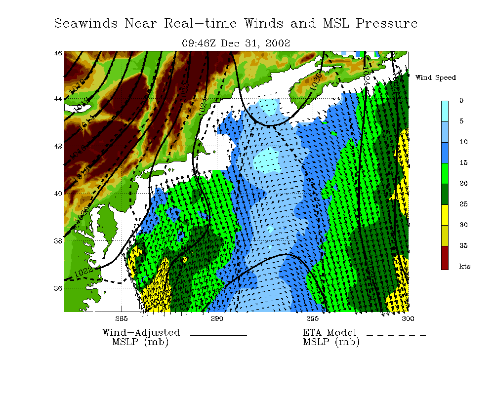
Latest Surface Pressure and Winds
(click on map to zoom in)
Click here for full-size image
Older Passes
(Large view only)
[an error occurred while processing this directive]
Click Here for a
full-sized image
Click on the map below to zoom in.
|
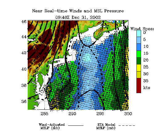
Latest Surface Pressure and Winds Click here for full-size image
Latest
Animation |
Click here for information on how surface pressures are computed
