[an error occurred while processing this directive]

       Northeast Atlantic Coast

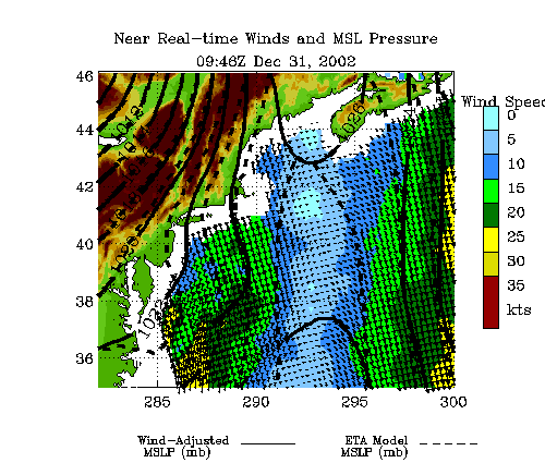
Latest Surface Pressure and Winds
(click on map to zoom in)

   Latest Pass


Older Passes
(Large view only)

   Indexed List


Latest Wind Animation

   Latest Animation

Click here for information on how surface pressures are computed

/scatterometry/ /lib/biblio/scatterometry/ / NSCAT Background QuickSCAT Background NSCAT Animations QSCAT Animations NSCAT Still Images QSCAT Still Images NSCAT Science Highlights QSCAT Science Highlights NSCAT Swath Data QSCAT Swath Data NSCAT Gridded Data QSCAT Swath Data NSCAT Calibration and Validation QSCAT Calibration and Validation